Balsall Heath is 750 years old, and the evidence takes us right back to Edward 1st ‘Longshanks’ or ‘Hammer of the Scots’.
The Earliest Record: 1275
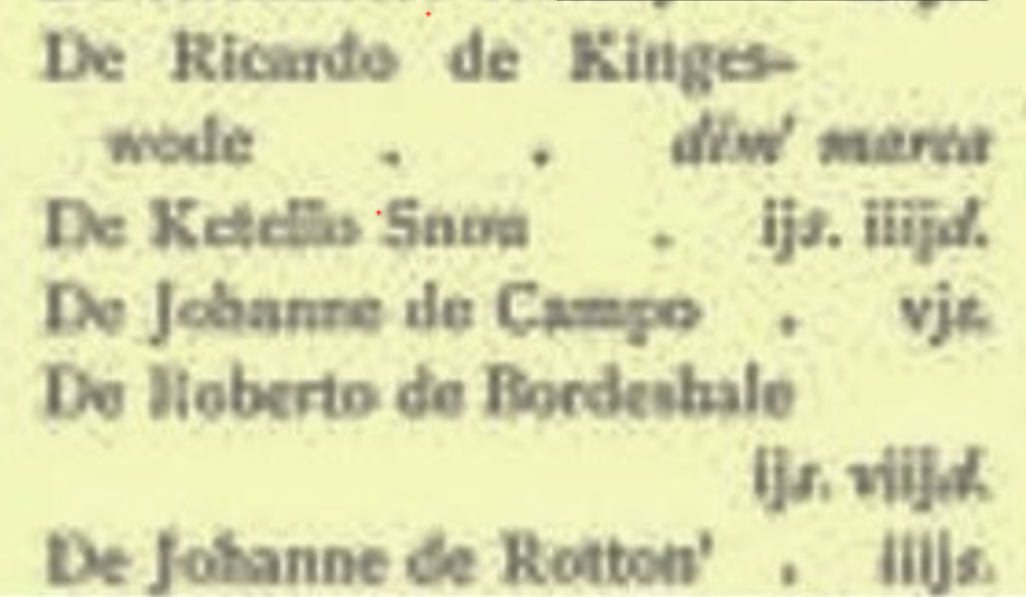
The earliest documented mention shows he original spelling was Bordeshale (Later contracted to the familiar ‘Balsall’). This places the area’s first official record early in King Edward I’s reign.
Bromsgrove and King’s Norton were Royal manors held ‘in ancient demesne’ by the king.
What Happened in 1275?
The official documentation was a direct result of the King’s efforts to modernize and tax people, passing laws to bring order and better admin. A key piece of legislation was the first Statute of Westminster. This law included new rules for taxes and land ownership. Before 1275 boundaries and ownership could be proven with simple oral evidence, but the new laws demanded that everything be formally recorded. A drive for better governance and tax collection that “Bordeshale” was officially put on the map!

Defining the Boundary
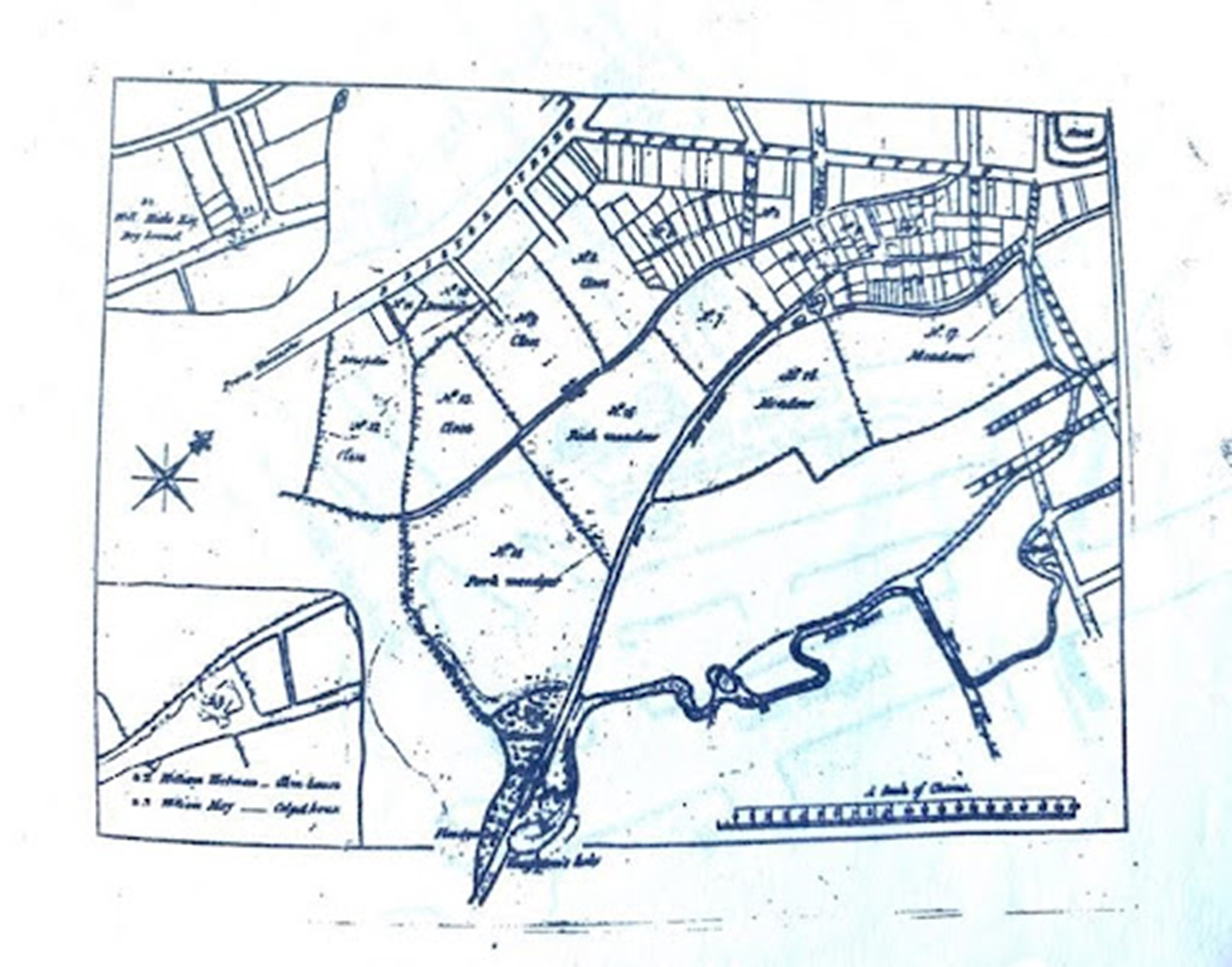
Long before it became an inner-city suburb, the area now known as Balsall Heath was defined by natural boundaries. The boundary of the historic Kings Norton manor was marked by the Bodesehale Brook. This brook ran roughly parallel to the present-day Belgrave Road before flowing into the River Rea.
This ancient line was so significant it was still used centuries later. In 1796, the brook was clearly marked on a Gooch estate map as the dividing line between Kings Norton parish in Worcestershire and Aston parish in Warwickshire:
What was Balsall Heath Like in 1275?
While the area was officially recorded, it wasn’t a town. Life in 1275 Balsall Heath was rooted in the landscape:
A watermill was certainly operating nearby, near what is now Cannon Hill Park, with records dating back even earlier to 1231. Farms likely dotted the fertile land along the Rea Valley.
The Heath. The higher ground was dominated by open heathland, which lay along the ancient ridgeway track—the same route that eventually developed into the Moseley Road.
So, when we celebrate 750 years, we’re celebrating its official birth, connecting our modern community back to the medieval landscape of Bordeshale!